


DELAWARE 15, Hamilton County, Indiana
About
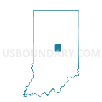
Outline

Summary
| Unique Area Identifier | 577536 |
| Name | DELAWARE 15 |
| County | Hamilton County |
| State | Indiana |
| Area (square miles) | 0.89 |
| Land Area (square miles) | 0.89 |
| Water Area (square miles) | 0.00 |
| % of Land Area | 99.60 |
| % of Water Area | 0.40 |
| Latitude of the Internal Point | 39.93467960 |
| Longtitude of the Internal Point | -85.99965270 |
Maps


Graphs
Select a template below for downloading or customizing gragh for DELAWARE 15, Hamilton County, Indiana


Neighbors
Neighoring Voting District (by Name) Neighboring Voting District on the Map
- DELAWARE 19, Hamilton County, IN
- DELAWARE 24, Hamilton County, IN
- FALL CREEK 07, Hamilton County, IN
- FALL CREEK 09, Hamilton County, IN
- FALL CREEK 29, Hamilton County, IN
- LA004, Marion County, IN
- LA005, Marion County, IN
- LA006, Marion County, IN
- LA007, Marion County, IN
Top 10 Neighboring County Subdivision (by Population) Neighboring County Subdivision on the Map
- Lawrence township, Marion County, IN (118,447)
- Fall Creek township, Hamilton County, IN (51,613)
- Delaware township, Hamilton County, IN (30,617)
Top 10 Neighboring Place (by Population) Neighboring Place on the Map
Top 10 Neighboring Unified School District (by Population) Neighboring Unified School District on the Map
- Lawrence Township Metropolitan School District, IN (95,614)
- Hamilton Southeastern Schools, IN (90,116)
Top 10 Neighboring State Legislative District Lower Chamber (by Population) Neighboring State Legislative District Lower Chamber on the Map
- State House District 29, IN (118,413)
- State House District 39, IN (76,305)
- State House District 88, IN (64,670)
Top 10 Neighboring State Legislative District Upper Chamber (by Population) Neighboring State Legislative District Upper Chamber on the Map
- State Senate District 28, IN (171,077)
- State Senate District 31, IN (127,702)
- State Senate District 30, IN (123,736)
Top 10 Neighboring 111th Congressional District (by Population) Neighboring 111th Congressional District on the Map
Top 10 Neighboring Census Tract (by Population) Neighboring Census Tract on the Map
- Census Tract 1108.05, Hamilton County, IN (8,002)
- Census Tract 1108.10, Hamilton County, IN (6,305)
- Census Tract 1108.07, Hamilton County, IN (5,461)
- Census Tract 3301.09, Marion County, IN (5,063)
- Census Tract 3301.08, Marion County, IN (3,874)